Drones For Geology
 |
| Drones for Geology |
Hydrocarbon exploration inarguably is benefiting from ongoing advances in technology – even if certain technical apparatuses being used appear to belong in a sci-fi movie rather than the oil patch.
Think drones. Sometimes looking a bit like super-size bugs hovering in the sky, these unmanned aerial vehicles (UAVs) are being used to meet various needs in the industry, proving to be useful both onshore and offshore.
They can be used, for example, to inspect oilfield equipment and pipelines and to monitor gas flares.
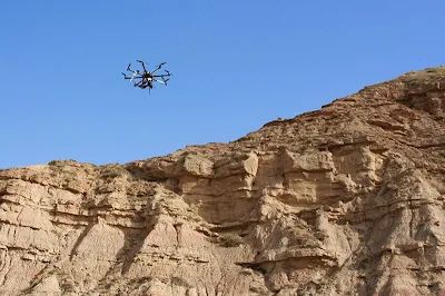
But their significance for the geologist is the ability to acquire up-close, highly detailed images of outcrops, particularly in high elevations where camera-equipped helicopters entail the usual element of risk along with considerable monetary output.
Piloted via remote control, the drones are essentially flying robots. They can safely fly at exceptionally low altitudes, enabling their digital cameras to capture extremely high-resolution images of the surface.
Granted, drones per se are not a new phenomenon, actually being commonplace in the military and in certain law enforcement agencies where they are used for aerial surveillance and myriad other tasks.
They can be small enough to hold in your hand, or they can resemble actual small-size aircraft. Reportedly, there is one the size of a hummingbird, appropriately called a “nano hummingbird.”
These oddities are beginning to make serious inroads into the private sector.
This is due in large part to the availability and incorporation of mini-size electronics and special software programs to handle the various data they can gather.
10 Reasons to be with a Geologist
10 Pictures that will make you want to become a Geologist
The world's 10 Most Deadly Minerals


%20(1).webp)


